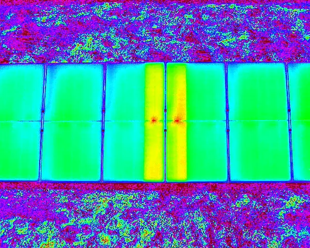
Solar Farm Drone Inspection
RGB aerial imagery, thermal drone imaging where conditions allow, progress records, and site overview media for solar fields and roof-mounted solar assets.
Industries
Drone imagery, mapping, thermal capture, and inspection media for Colorado solar, utility, power infrastructure, and energy sites.
Energy Drone Services
Alpine Aerial Photography supports Colorado solar, power and utility, oil and gas, and energy-adjacent projects with aerial photography, video, thermal drone inspection media, high-resolution aerial mapping, LiDAR data collection, photogrammetry, orthomosaic maps, 3D site modeling, and GIS-ready drone data.
The work is scoped around safety, site access, deliverables, and the maintenance teams, contractors, engineers, asset managers, and qualified specialists who will review the imagery and data.
Services
Use drone capture for safer access, faster documentation, planning records, mapping support, GIS integration, and communication across large or difficult-to-access energy sites.
RGB aerial imagery, thermal drone imaging where conditions allow, progress records, and site overview media for solar fields and roof-mounted solar assets.
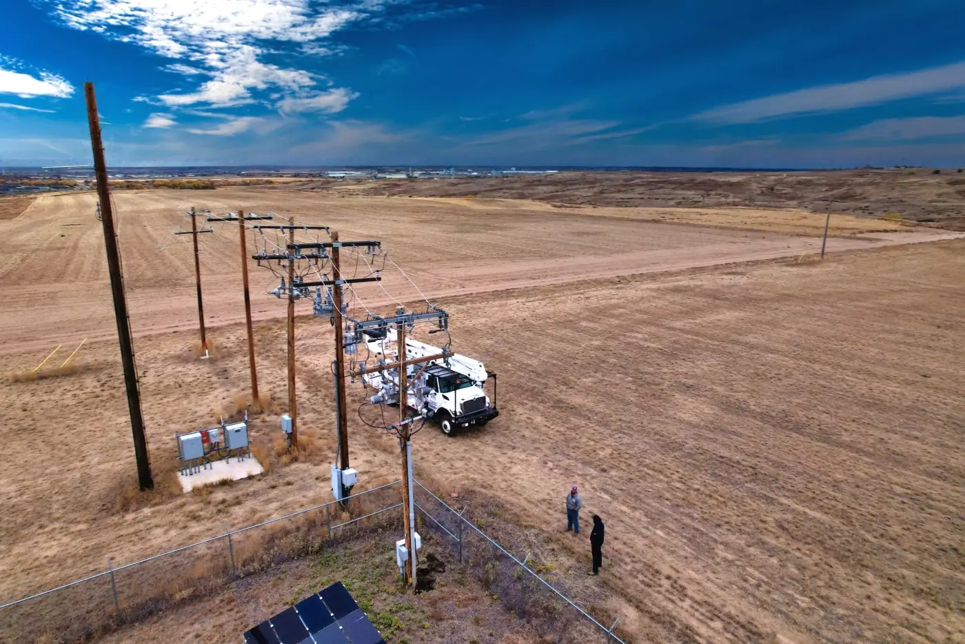
Visual documentation for power poles, substations, utility corridors, access routes, and hard-to-access power infrastructure.
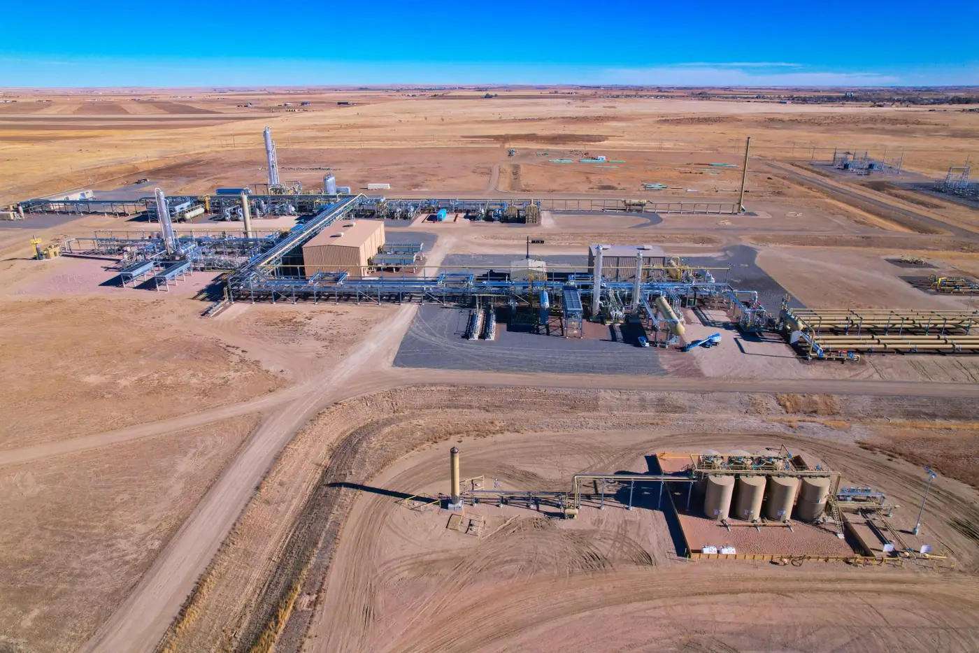
Aerial photos and video for oil and gas site context, access documentation, maintenance planning, and reporting support.
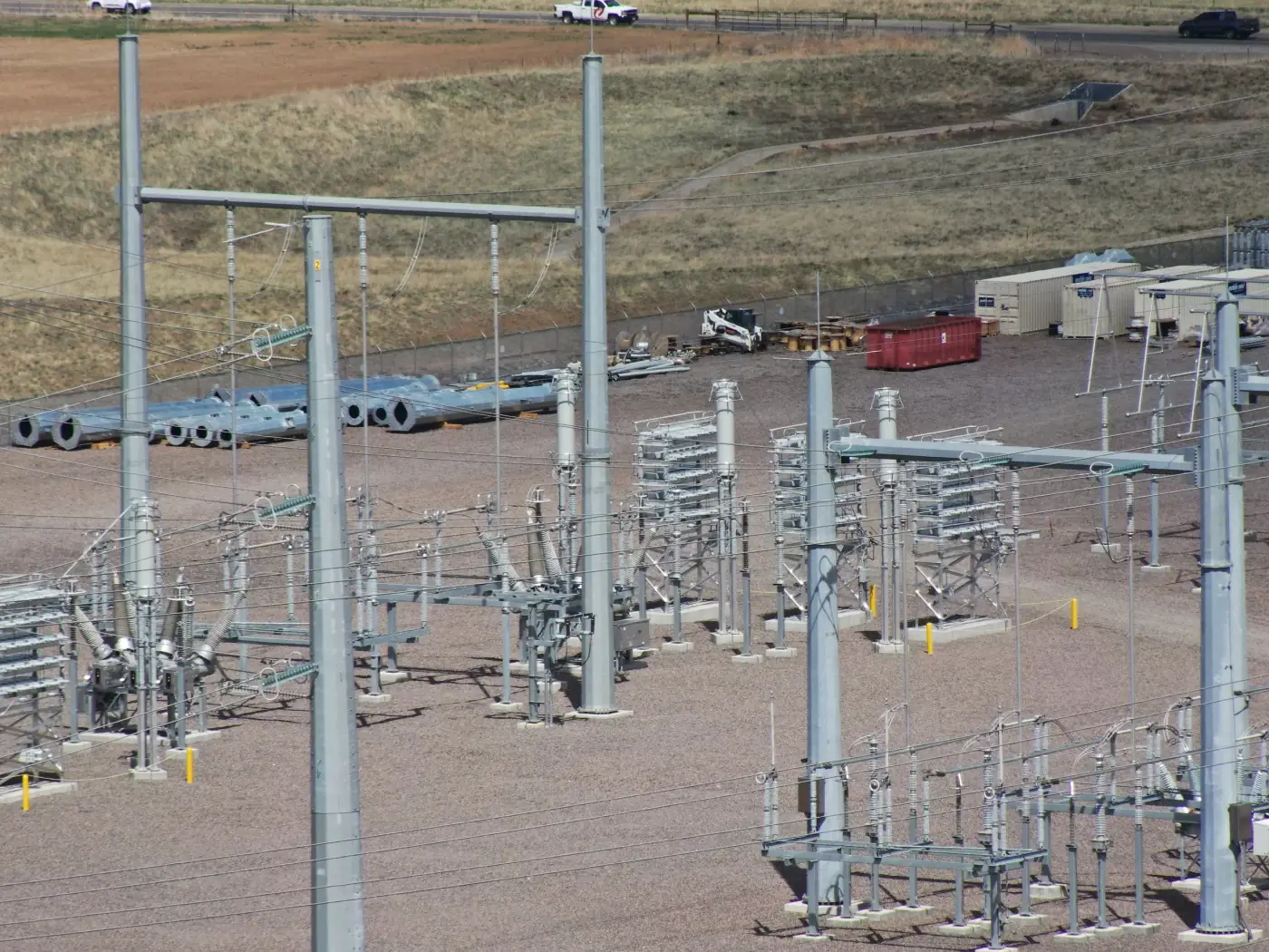
Orthomosaic mapping, drone LiDAR mapping, photogrammetry, 3D site models, and GIS-ready outputs for planning and asset management.
Gallery
Energy projects often need broad site context, detailed asset imagery, thermal support, repeatable records, and mapping outputs that can be shared with technical teams.
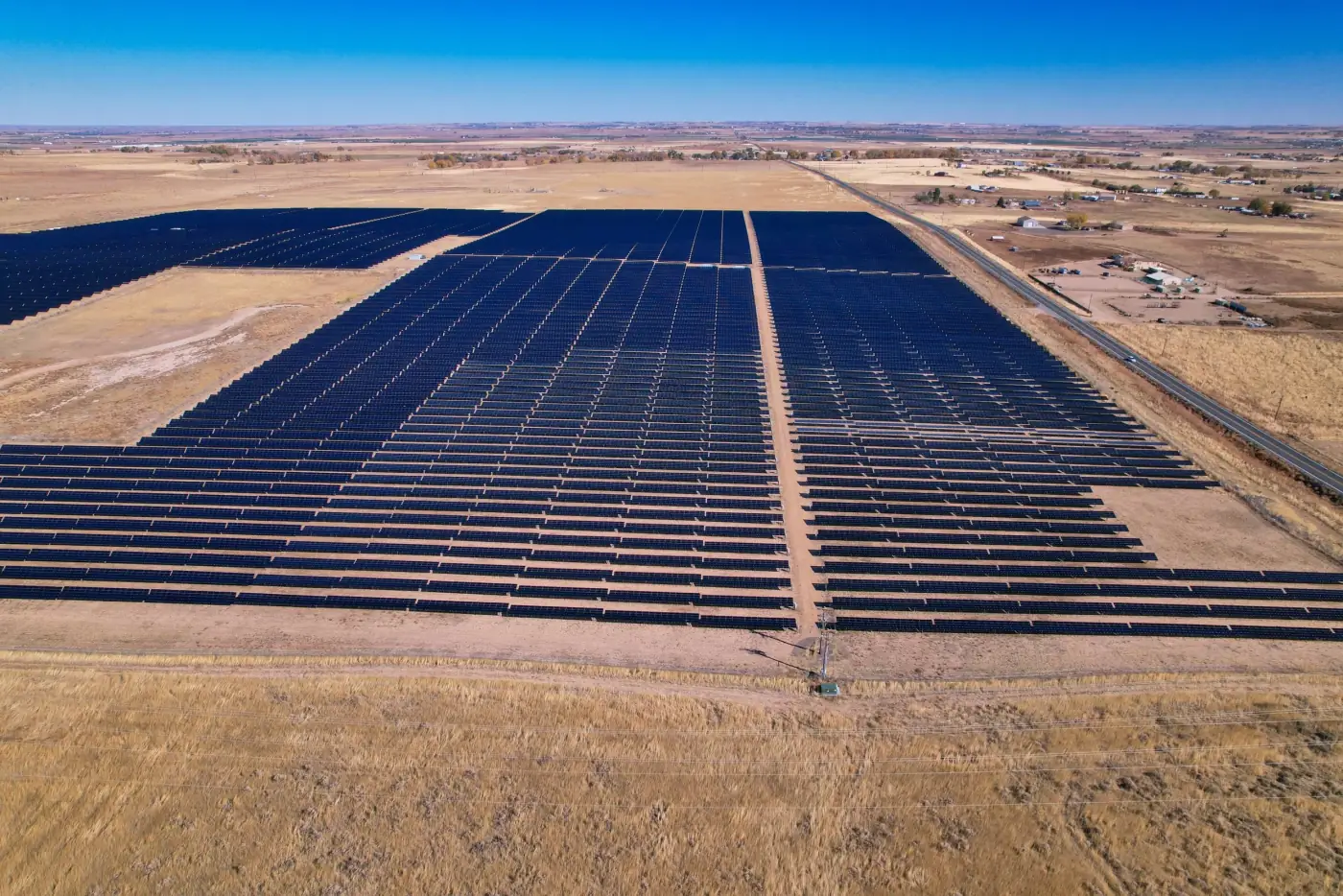
Energy Documentation
Drone imagery can support planning, maintenance conversations, reporting, GIS integration, and specialist review without overpromising diagnostics.
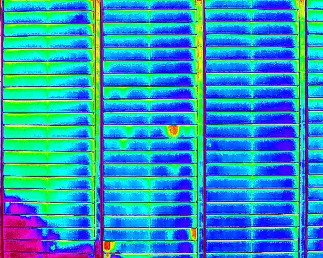
Use Cases
Drone energy inspections and mapping are useful when teams need safer inspection media, faster site documentation, or clear visual records for planning, maintenance, asset management, and reporting.
Solar farm drone inspection and roof-mounted solar documentation
Power and utility drone inspection for poles, substations, corridors, and access routes
Oil and gas drone inspection media for site overview, maintenance planning, and reporting
Thermal drone inspection support for potential heat anomalies on panels, roof-mounted solar, or equipment
Aerial mapping for energy sites with orthomosaic maps and 3D site models
Drone LiDAR mapping and photogrammetry for terrain, access, and site visualization
GIS data integration for asset management and planning
Progress documentation and site overview media for internal and stakeholder communication
Process
The right capture plan depends on the asset type, site rules, safety needs, thermal conditions, mapping requirements, and final review workflow.
Step 1
Identify whether the project involves solar, utilities, oil and gas, pipelines, substations, corridors, or roof-mounted solar, then define the imagery, map, model, or GIS output needed.
Step 2
Coordinate site contacts, airspace, hazards, escorts, operating limits, and timing before flight.
Step 3
Collect RGB photos, video, thermal imagery, LiDAR, photogrammetry, orthomosaic mapping data, or 3D model source imagery.
Step 4
Prepare inspection media, maps, models, datasets, folders, and GIS-ready outputs for maintenance teams, contractors, engineers, owners, and qualified specialists.
Workflow
Before flight, we define site access, hazards, required imagery, thermal needs, mapping scope, LiDAR or photogrammetry requirements, GIS data format, delivery expectations, and who will review the files.
Some energy assets require escorts, safety rules, special timing, facility coordination, or additional permissions before drone operations. Thermal imagery is planned around conditions and is best used as supporting documentation for qualified professionals.
Drone imagery and thermal data can help identify potential anomalies and support energy workflows, but final technical interpretation should come from qualified energy, solar, electrical, engineering, roofing, or inspection professionals. Alpine Aerial Photography is not a licensed surveyor, and maps are not a replacement for a licensed survey where one is required.
Why Alpine Aerial Photography
Alpine Aerial Photography combines careful drone operations with practical mapping, thermal, LiDAR, GIS, and visual communication experience for Colorado energy projects.
Solar, utility, oil and gas, and energy infrastructure documentation
RGB aerial photography, video, and site overview media
Thermal drone imaging where conditions support it
LiDAR, photogrammetry, orthomosaic mapping, and 3D models
GIS-ready drone data for planning and asset workflows
Clear limits around diagnostics, engineering, and survey-grade work
FAQ
Drones can capture high-resolution photos, video, thermal imagery, orthomosaic maps, LiDAR data, and 3D site references for solar fields, substations, utility corridors, pipelines, and other energy infrastructure. The imagery supports planning, maintenance, reporting, and review by qualified professionals.
Yes. Solar farm drone inspection media can include RGB aerial imagery, close visual documentation, thermal drone imaging when conditions are appropriate, orthomosaic mapping, progress documentation, and GIS-ready outputs for asset teams.
Thermal drone inspection can help identify potential heat anomalies on solar panels or related equipment. Alpine Aerial Photography provides the visual and thermal documentation, while qualified solar, electrical, or engineering professionals should interpret findings and determine next steps.
Yes. Deliverables can include high-resolution aerial mapping, orthomosaic maps for planning and documentation, 3D models for visualization and site understanding, LiDAR datasets, and survey-informed visual documentation for energy sites.
Yes. Alpine Aerial Photography can prepare GIS-ready drone data and mapping outputs that support asset management, planning, reporting, and integration with existing GIS workflows.
Alpine Aerial Photography is not a licensed surveyor and drone maps are not a replacement for a licensed survey where one is required. When survey-grade deliverables, legal boundaries, or stamped products are needed, the work should be coordinated with a licensed surveyor.
Start a Project
Tell us about the asset type, site location, thermal needs, mapping scope, and deliverables. We'll help scope the right aerial workflow.