
Drone Mapping and Inspections
Our Drone mapping and inspection services are becoming increasingly popular for industries such as architecture, construction, engineering and insurance. Our Drones are equipped with cameras and sensors that can be used to quickly capture high-resolution images and data, which can be used to create detailed 2D and 3D maps and models of buildings, landscapes, and other physical assets. These maps and models are great for visualizing and analyzing these locations.
-
Roof Inspections
Using our drones we can aid in roof inspections. We can easily and safely gather data of hard to reach places so you can make informed decisions. In the past we have worked to make high resolution 3d models of roofs and gathered data for a range of inspection purposes .
-

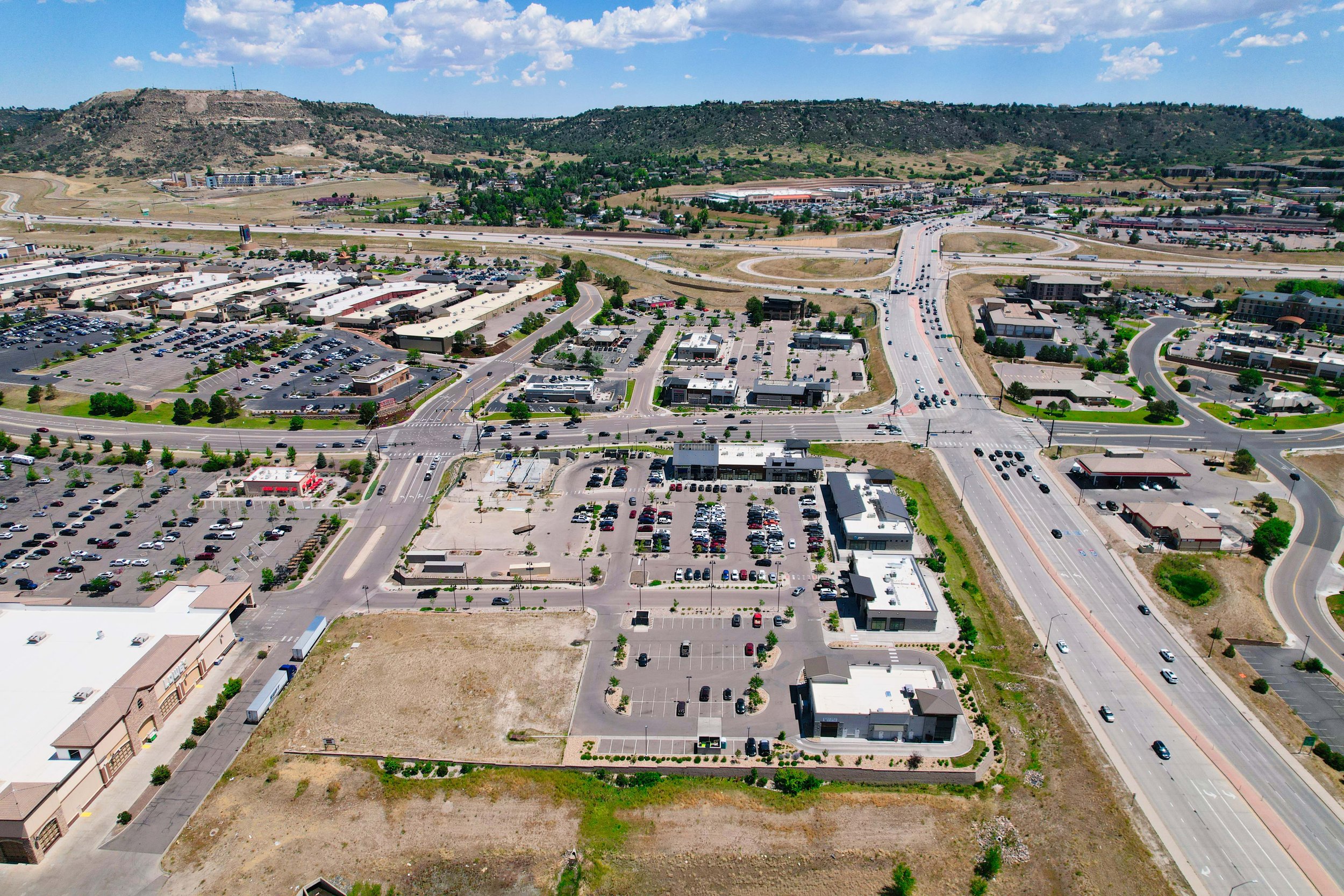
Infrastructure
Drones are being used to inspect and map infrastructure such as roads, bridges, and power lines. This allows engineers to quickly and accurately assess the condition of the infrastructure and plan maintenance and repairs. Using drones for infrastructure inspection and mapping can save time, money, and resources, and can also be safer than traditional methods.
-

3D modeling and photogrammetry
Drones can be used to create 3D models of buildings, landscapes, and other structures. This is valuable for architects, urban planners, and engineers, who can use the models to visualize and analyze the structures, plan renovations and improvements, and identify potential issues
-

Mapping and Othrophotos
We have significant experience in creating high-quality videos that are perfect for YouTube. We've worked on a range of video projects for our clients, ranging from short films to YouTube videos. Let us know what you're looking for and we'll find the perfect solution for your business needs!
-

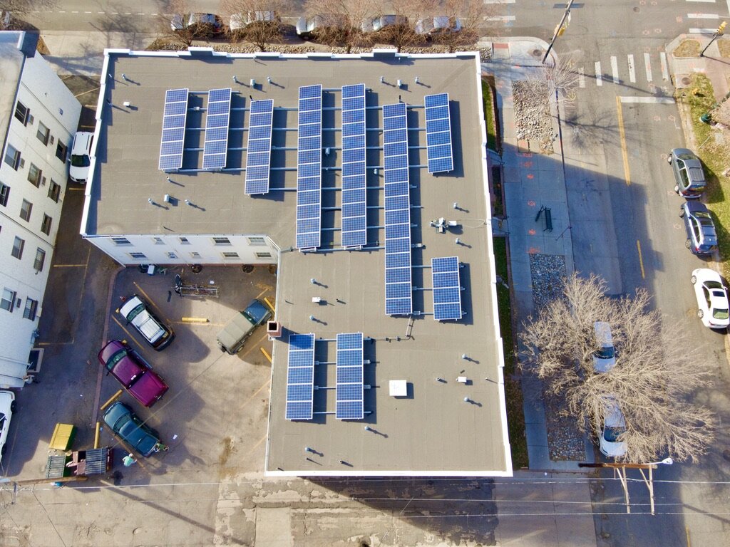
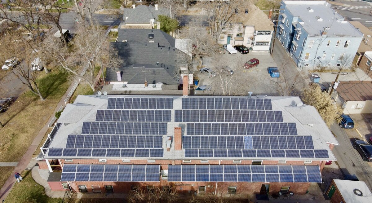
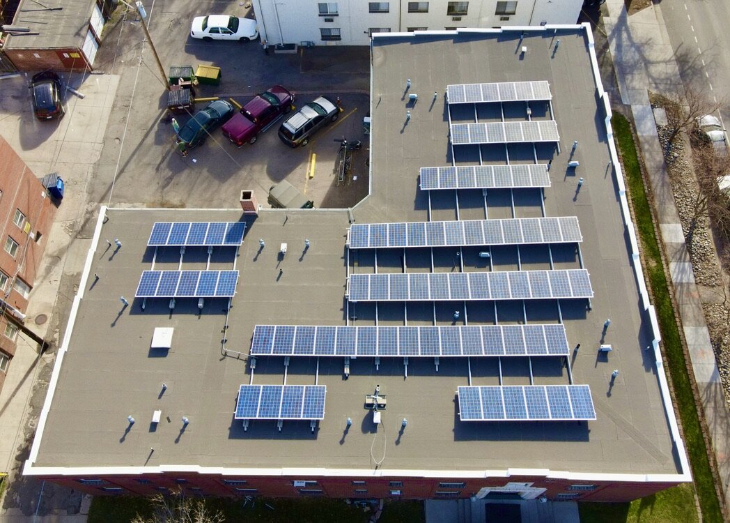
Thermal Solar panel Inspections
Using Our Drones equipped with Thermal Cameras we can inspect and Find damage in Solar PV panels
-

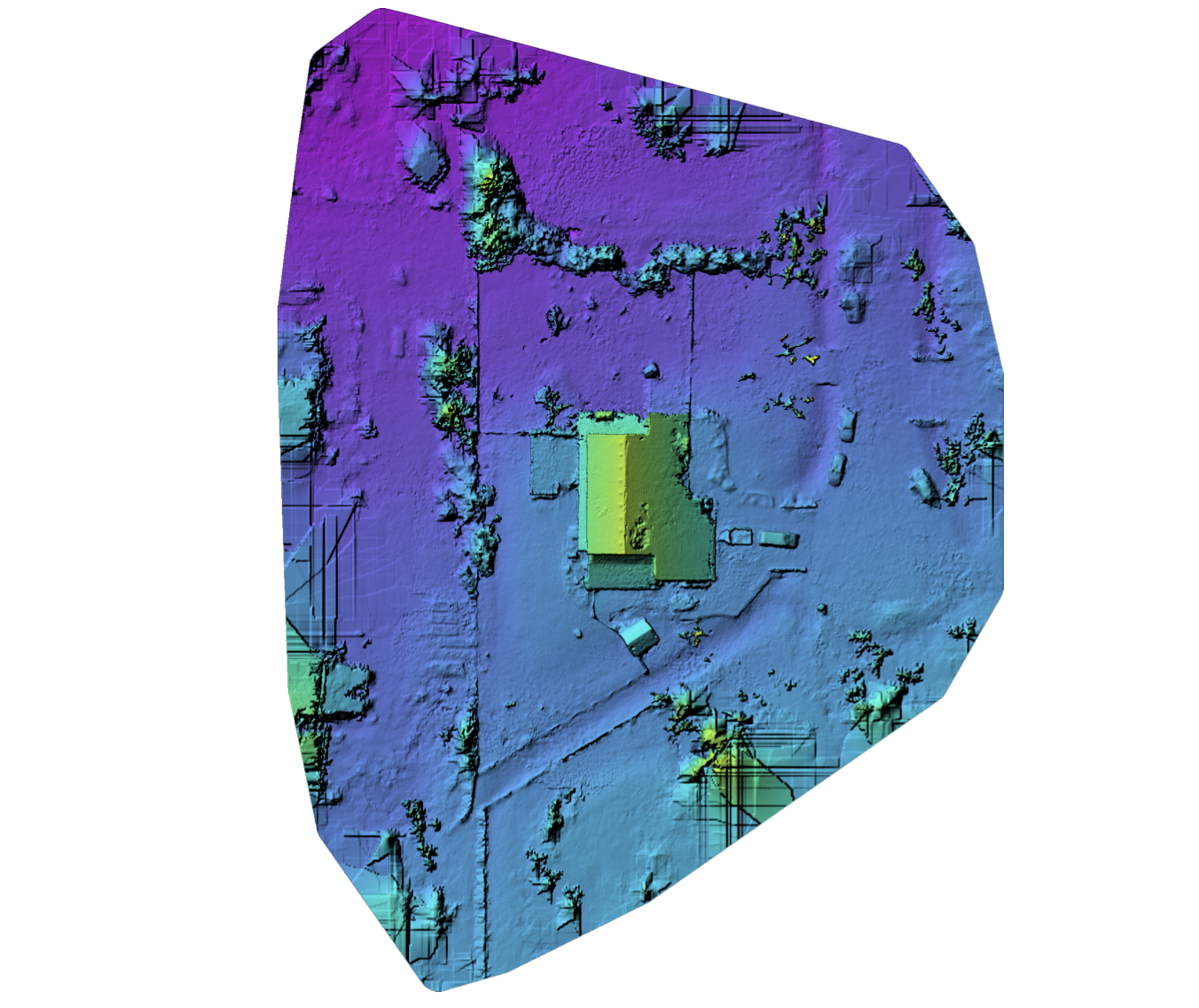
Drone LiDAR Mapping
Using Drones equipped with Lidar sensors and RTK basestations we can provide accurate LiDAR Point Clouds and maps for inspections, construction and engineering.
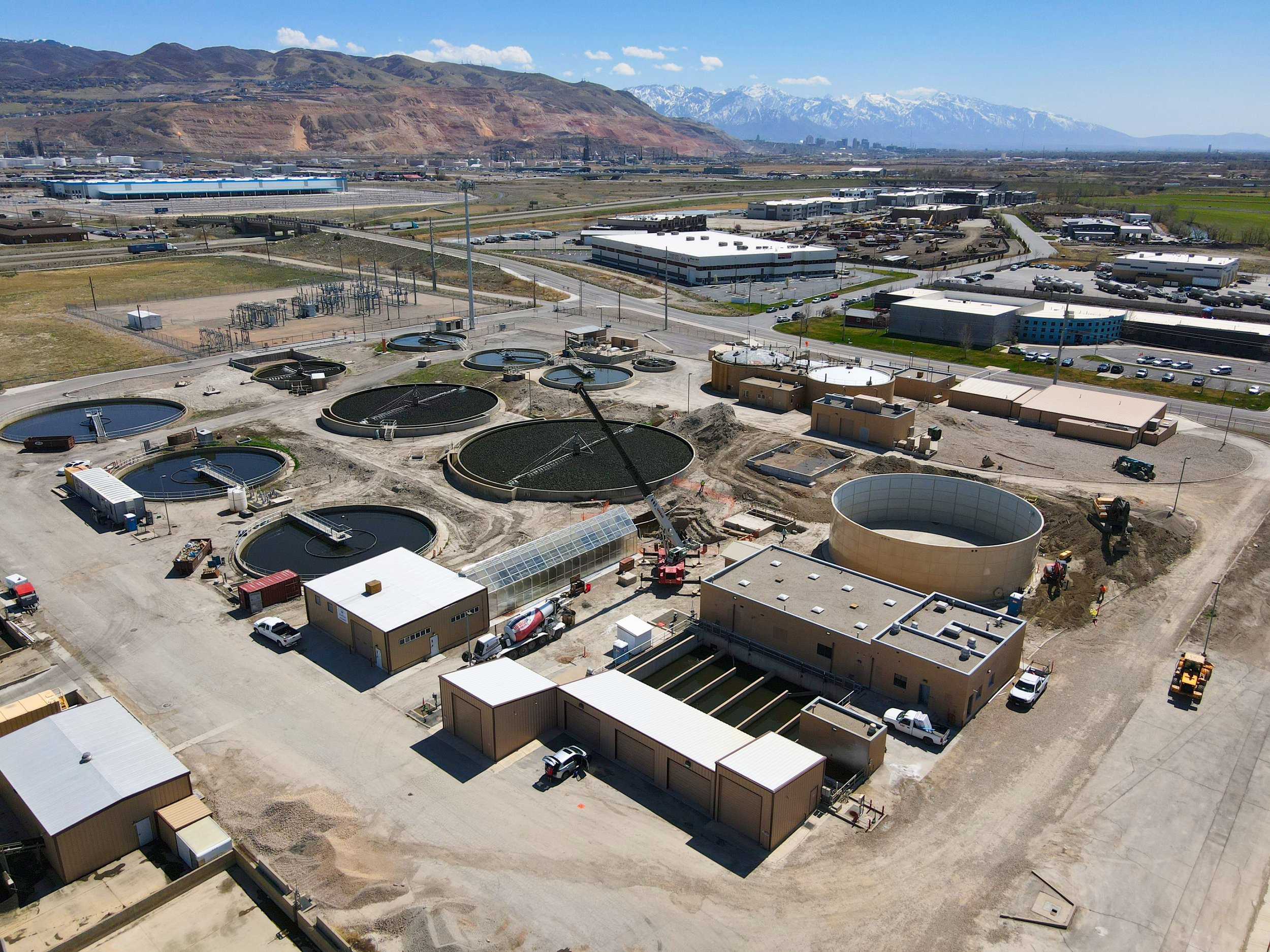
Waste-Water Plant Aerial Photos

Water tower Inspections using drones
Drone Mapping Boulder Colorado
Residential Roof inspections using drones

Construction site mapping data collection

Construction site modeling

Drone 3d Modeling

3D modeling and drone data collection

Drone Roof HVAC inspection

Solar Drone Inspections Colorado
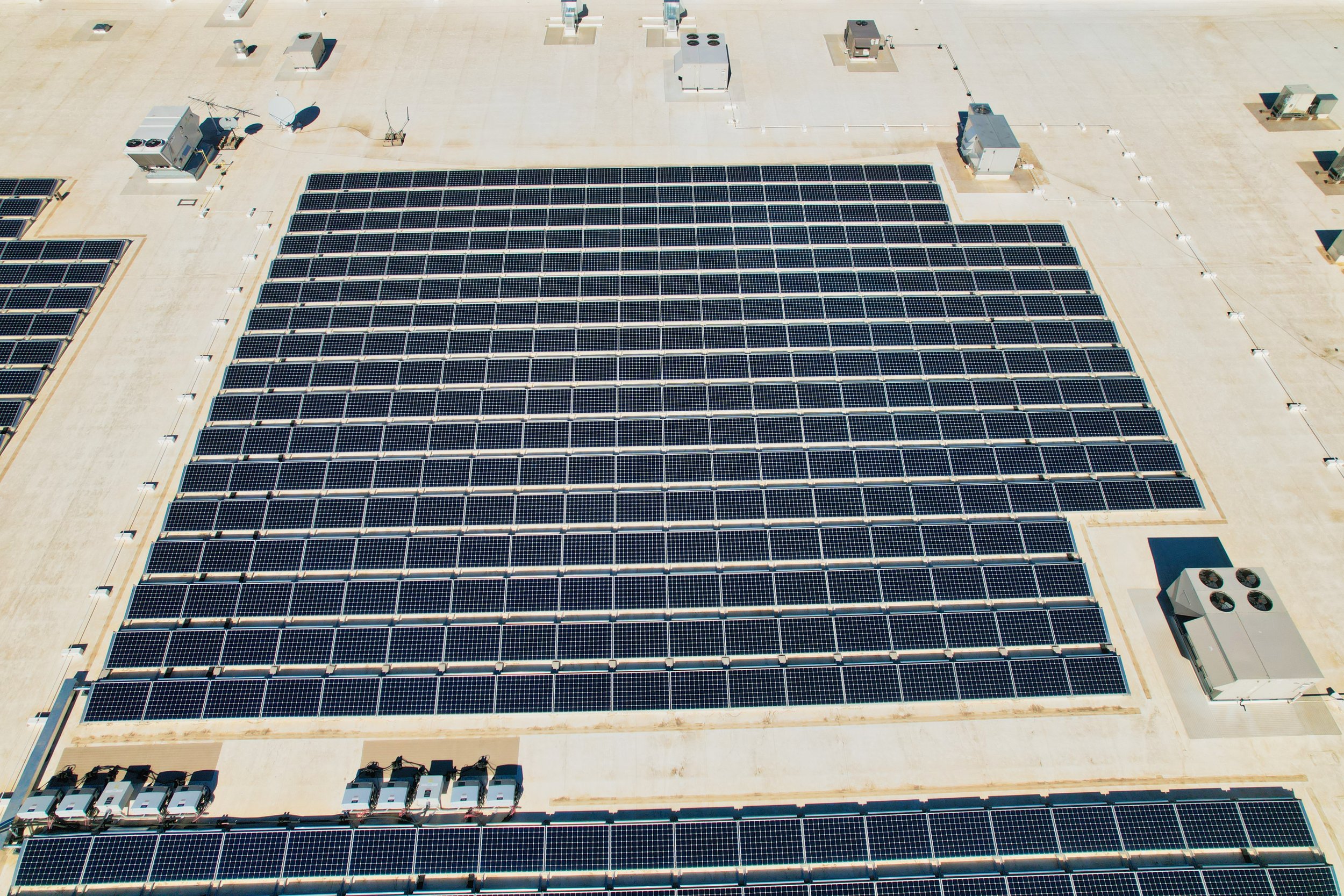
Inspecting solar panels on roof using drones
Drone mapping and 3d Modeling Colorado
Our standard service areas Include Boulder, Denver Metro, Longmont, Loveland, Golden and Ft.Collins but we are happy to travel!